The Shortcut That Adds Work: A Common Wayfinding Mistake
A shortest-looking cycling route can hide awkward turns. Compare decision points and path connections to choose a local journey that is easier to follow.
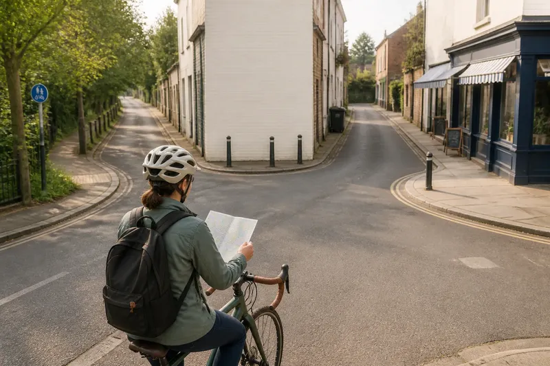
You leave the library for the market, glance at the map and choose the thin line behind the shops. A few minutes later, you are beside a blank wall, deciding which of three openings leads to the next street. The shortest-looking cycling route has become a small navigation job.
Distance matters, but so does how clearly a route unfolds. A useful choice lets you recognise each turn in time and keeps your attention on the street, rather than on decoding a line on a screen.
Short lines can hide complicated turns
A map reduces the town to a line and a few labels. On the ground, that line might pass through a staggered junction, bend around a school, cross a broad road and reappear on a street with a different name. Each change asks you to make a decision while watching traffic, people and the surface ahead.
Look beyond the number of streets. Notice how often you must choose which side of a divided road to use, where a path meets a street, or whether a turn comes before or after a row of shops. A route with fewer changes of direction may be easier to follow, even if it takes a wider arc.
Think of a route like a sentence: clear punctuation helps you understand what comes next. A cluster of tiny changes can be harder to follow than one distinct turn, much as a sentence with too many commas can be difficult to read.
Closely spaced turns make shortcuts hard to follow
A succession of turns can arrive before you have settled after the first one. The next street may look like a driveway, or a junction may be obscured by shopfronts and parked delivery vehicles. If you are still working out where the first turn led, the next decision is already upon you.
This can happen when a route planner links short residential streets, cut-throughs and shared paths. Before riding, trace the route one turn at a time. Identify the street or path after each important turn and note a visible cue near the junction, such as a bridge, park entrance or distinctive corner building. If several turns have no clear cues, compare a route with fewer decisions.
Say you are going from a neighbourhood library to a swimming pool. The direct option crosses three short lanes behind shops, then turns beside a car park. Imagine the car park entrance could be mistaken for the lane. A route along the edge of the park instead has one recognisable entrance and a clear street connection. The expected trade-off is a less direct line for fewer ambiguous decisions.
Choose landmarks that point to a specific turn
A memorable landmark is not always a useful cue. “Turn at the supermarket” does not say whether the turn is before the entrance, opposite it or at the next road. A large building may also sit back from the street or extend across several blocks.
Look for a cue that connects directly to the decision: a bridge crossing, a path entrance beside a playground, a distinctive building on a corner, or the junction where a main street meets a quieter one. Prefer something visible as you approach, not a feature that appears only after you have passed the turn.
For an important turn, pair a street name with a physical feature. The name helps if the sign is visible; the feature can help if it is not. Avoid relying on temporary displays, parked vehicles or a business sign that could change.
At a park or canal, check exactly where the path joins the street. Several entrances may lead to the same place. If the intended opening is unclear, compare it with a street-side connection that has a recognisable crossing or junction.
Check where paths change or end
A line on a map can make a cycle path, riverside trail or pedestrian cut-through look continuous. On the ground, it may meet steps, narrow into a footpath, cross a service road or reach a gate. The map shows a possible connection; it does not settle whether the route is accessible or suitable for your journey.
Pay particular attention to transitions: where the route leaves a street, crosses a road, reaches a bridge or enters a park. If the map is unclear, zoom in and compare it with another map layer or a local council cycle map, if available. Check access signs and local rules rather than assuming a route label tells the whole story.
A name such as “canal path” may cover several possible connections without saying which bank to use or where to join. Trace the approach and exit as well as the long stretch in between. If you find an unexpected barrier or unclear connection, do not make a sudden turn into traffic or continue into a place whose access is uncertain. Choose a safe place to stop, then work out a clear, lawful way to continue.
Check the decisions before choosing a shortcut
Use this list to compare routes before setting off. Each observation points to a practical choice rather than a demand to memorise every bend.
- Start point: Check which entrance or side of the building the route begins from. If the pin is on the wrong side, set the start point to the entrance you will actually use; otherwise, keep it.
- Turn sequence: Check the street or path reached after each important turn. If two turns are easy to confuse, choose a route with clearer connections; otherwise, keep the sequence as planned.
- Nearby turns: Check whether several decisions come close together and whether each has a visible cue. If the order is unclear, compare an option with fewer turns; if the cues are distinct, the shorter route may remain workable.
- Path entrances: Check where a path begins and how it meets the next street. If the entrance or exit is uncertain, choose a connection you can identify; if both ends are clear, keep the path in consideration.
- Crossings and access: Check for road crossings, gates, steps or signs that affect access. If a restriction or unsuitable connection appears, reject that section and find a permitted alternative; otherwise, retain it.
- Recovery point: Check for a clear public place or street where you could stop if you lose the route. If none is apparent near a complicated section, choose a route with an easier place to pause; if one is available, note it before leaving.
What should you do when the map and street differ?
Should you follow the phone or the road signs?
Use the phone to understand the planned route, then read signs and the street as you approach. If an instruction conflicts with a closure sign or access restriction, do not enter; choose a clear, lawful alternative.
Is a familiar main road always easier to follow?
Not necessarily. Familiarity can help with orientation, but junctions and traffic still need attention. Compare the turns, crossings and cues rather than assuming a well-known road will be simpler.
What should you do if you miss a turn?
Continue only if the street remains safe and permitted, then stop somewhere suitable to check your position. Rejoin through a clear connection instead of making an abrupt correction across traffic or entering a place you cannot identify.
When is a longer route the better choice?
A longer option can be easier to follow if it avoids ambiguous entrances, tightly spaced turns or uncertain path connections. Choose it when the clearer sequence is worth more to you than the shorter line.
Choose the route that stays clear at its hardest points
There is no need to reject every shortcut. A short route can be simple when it follows a recognisable street and has clear connections. The useful distinction is between a route that is both short and legible, and one that saves distance by asking you to interpret several small details while riding.
Compare the turns, landmarks and path transitions rather than judging by the shape of the line alone. The shortest-looking cycling route is a good choice when you can tell what to do at the points that matter, without giving the map more attention than the street deserves.
Before leaving, note the name or visible feature of the street you expect to reach after a complicated junction. If neither appears, you have an early sign that the route has changed. You can then choose a safe place to stop and make a deliberate adjustment instead of correcting course in a hurry.